Provide information on the composition of landscapes with an accounting area and their changes over time. Ecosystem assets are classified according to their ecosystem type, here following the European ecosystem typology.
A workflow was developed to first generate EUNIS habitat maps by combining different geospatial datasets (Sentinel-1 and Sentinel-2 time series, Digital Elevation Model, climate, soil) with ground-truth sampling points. The hierarchical EUNIS habitat maps were thereafter joined with Land Cover (Corine backbone, Copernicus High Resolution layers), WorldCereal) and Land Use (Open Street Map) through a rule-based model to generate Ecosystem extent maps at Level-1 up to Level-3. At level-3, focus was set on natural landscapes for forest and woodland, and coastal ecosystem types. More information can be found in User Manual and Algorithm Theoretical Base Document.
Ecosystem extent accounts were generated for Slovakia (entire country) and Greece (Peloponnese) for the year 2020. The demonstration system is now being integrated, improved and expanded in the World Ecosystem Extent Dynamics project.
Slovakia

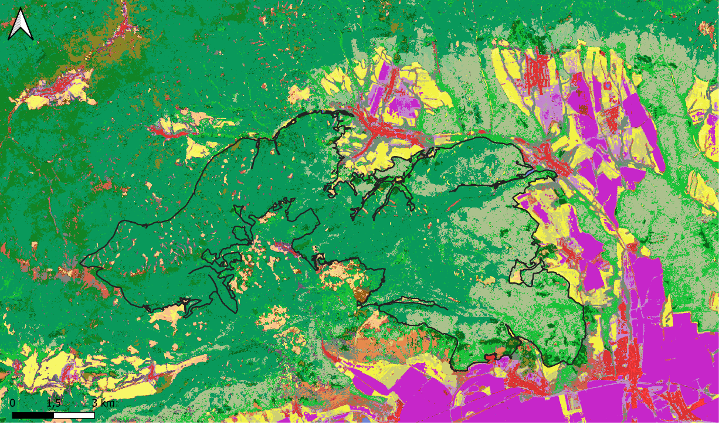
The ecosystem extent map shows a share of 42% forest and woodland and 30% of cropland, while slightly more than 3% has been sealed. The forest consists mainly out of broadleaved deciduous Fagus dominated trees followed by Thermophilous deciduous trees.
The extent account was validated for the Slovak Karst and Devon lake areas, through comparing with ground-truth data assembled in the year 2024. The Slovak Karst is one of the mountain regions at the Slovak Rudohorie mountains in the Carpathians in southern Slovakia. It consists of huge karst plains and plateaus and has been declared as a UNESCO Biosphere Reserve.
At level-1 and level-2 an accuracy of above 90% was reached, while at level-3 the accuracy dropped to slightly higher than 60%. This drop was mostly assigned to the worse detection of Ravine and Carpinus and Quercus mesic deciduous forest types, as well as wetlands.
Peloponnese, Greece

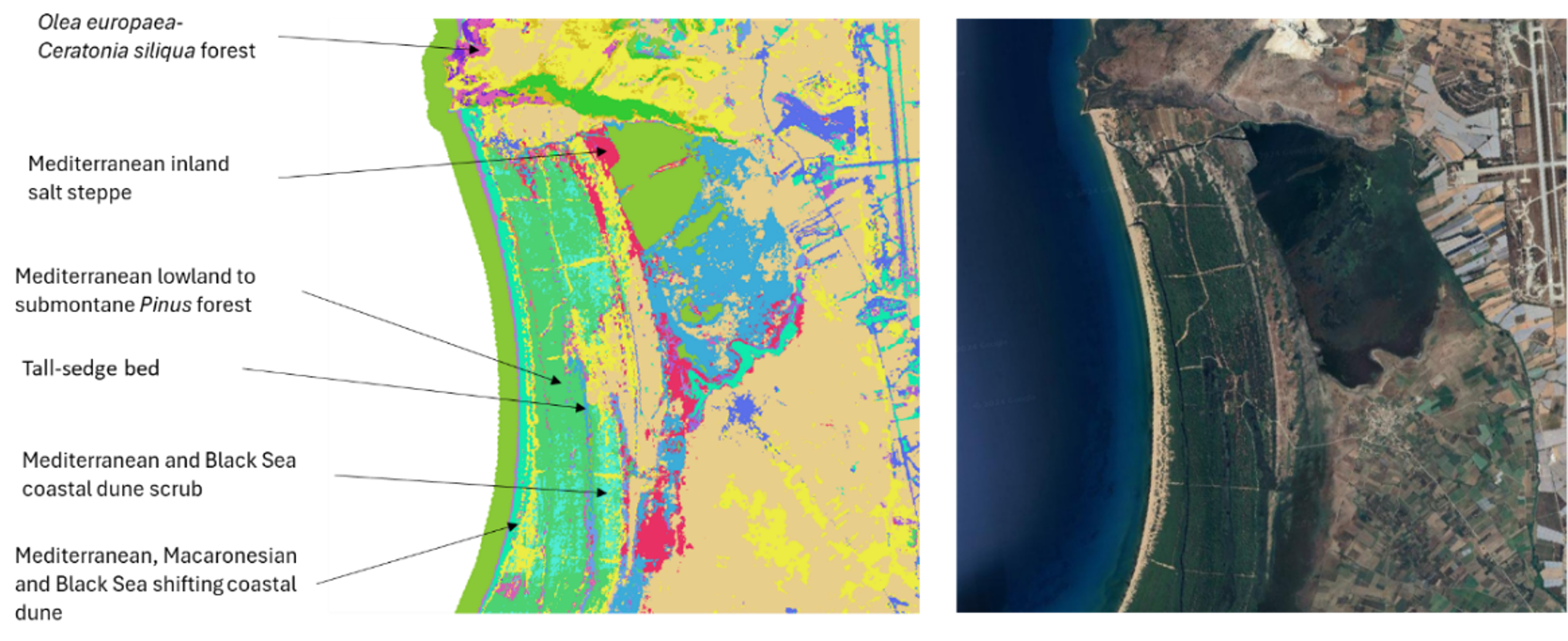
A second ecosystem extent map was generated using ground-truth data to train the EUNIS habitat models for Peloponnese, a peninsula located at the southern tip of the mainland in Greece with a size of 21 thousand square kilometers. Dominated by a landscape of forested mountains, it is not only known for its cultural heritage but also for its huge variation in natural landscapes with a large amount of bird species.
The ecosystem account shows that about 70% of the land assigned to nature (mainly forest and woodland, and heathland and shrub). The coastal ecosystem represents more than 13.000 hectares of which 75% is artificial shorelines.
